Slash Run: How a DC stream became a sewer, and then a secret
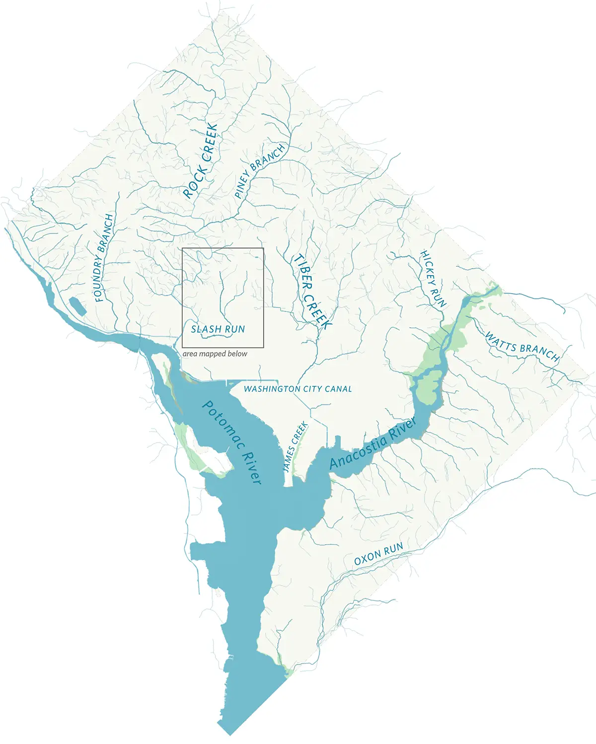
The DC stream network as it might have appeared in the mid-1800s.
Through the end of the 19th century, most of the District of Columbia was rural, a mixture of woodland, brush, farm fields, and orchards, broken by the occasional suburban subdivision. A network of streams flowed through this landscape, rushing down from the hills, through low ground and marshes, and into the tidal waters of the Potomac and the Anacostia. Some 70 percent of the early city’s streams are gone today, but we can reconstruct their paths. This piece looks at two of those lost streams, Slash Run and Brown’s Run, which once flowed from Adams Morgan and through Dupont Circle.
Slash Run’s headwaters
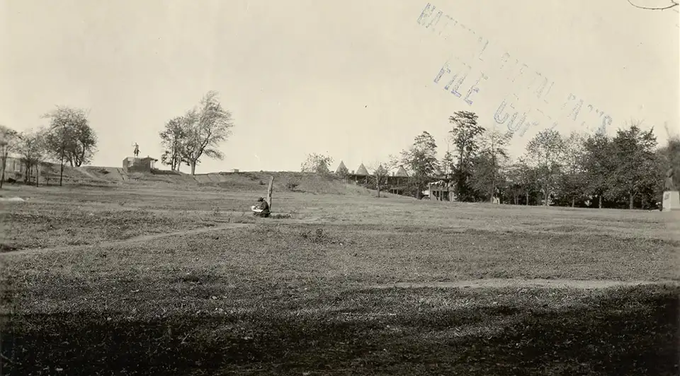
Malcolm X/Meridian Hill Park, around 1922, before the construction of the cascade and terraces, via the National Park Service. Brown’s Run ran down this escarpment, one block to the east.
Picture a raindrop falling on Kalorama Road, where the street veers off of 16th Street. A drop of water here would roll off to the southwest, down Kalorama, seeking a path downhill. The street drops into a valley, and the grade grows steeper half a block in. On the sidestreets, the rowhouses climb the valley sides in gentle stairsteps. There was a stream flowing through this place, before Adams Morgan grew into a neighborhood, before rowhouses replaced fields and orchards.
Kalorama is a short road. This little valley meets another one that follows the line of Champlain Street — or rather, Champlain Street follows the course of another small brook. For a bicyclist, the Champlain Street valley still offers a shallower grade than the steep ascent up the shoulder of Meridian Hill. Water still flows through this place but in sewer mains buried beneath the pavement.
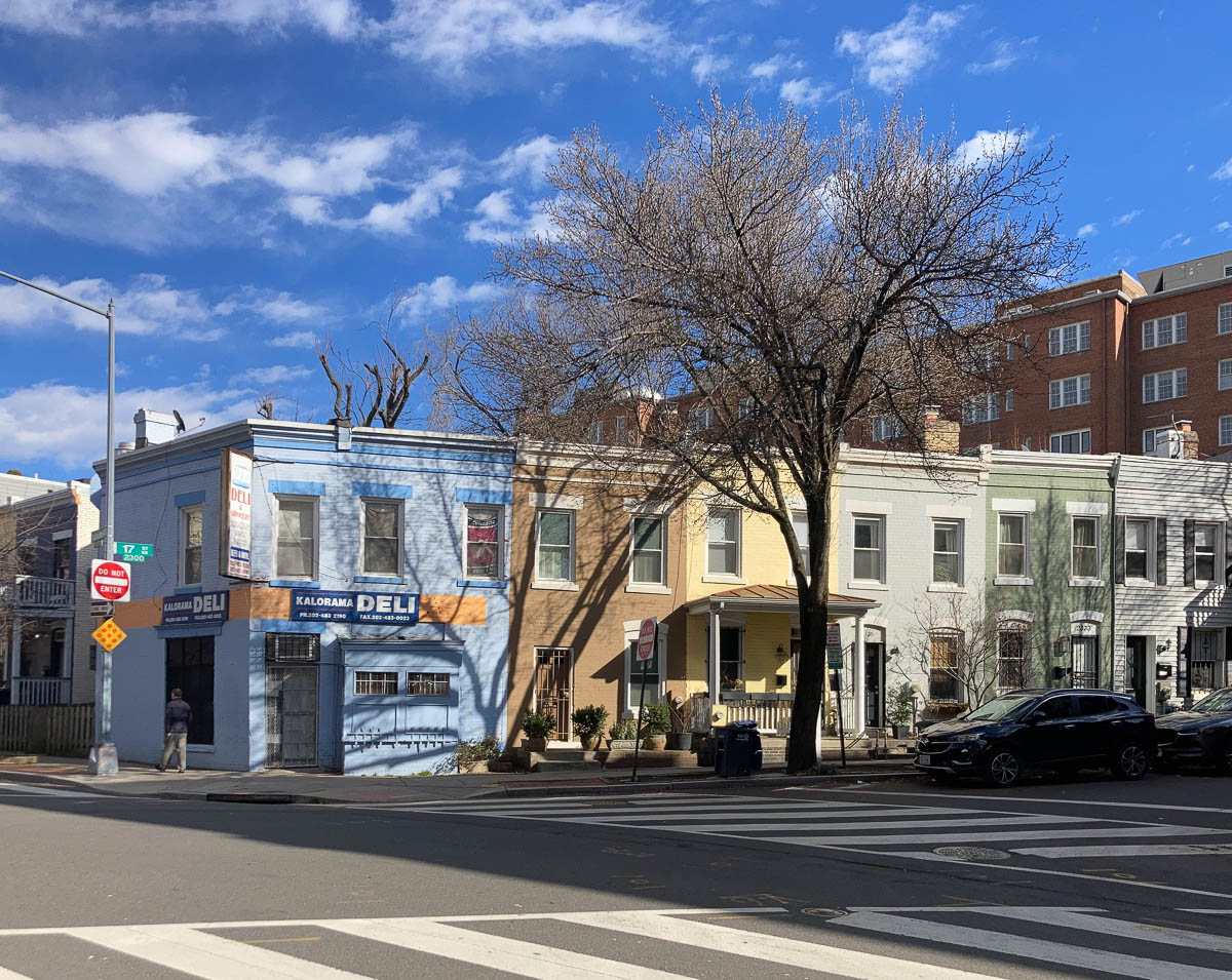
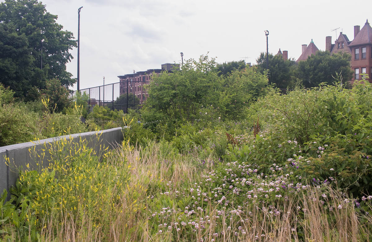
Rowhouses at 17th St. and Kalorama Rd. NW, on the side of the stream valley. Slash Run is gone, but the topography that it carved out still survives.
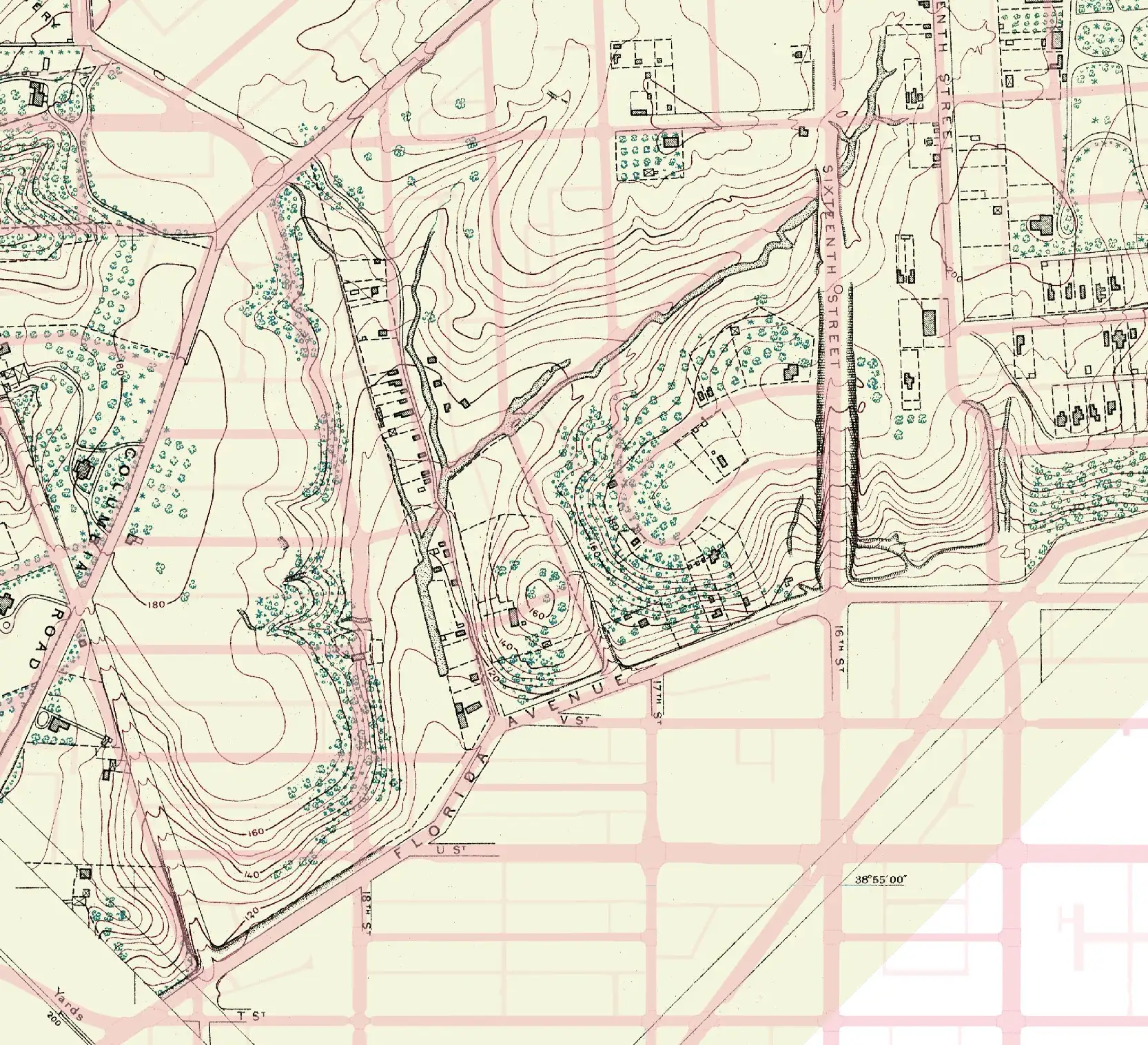
Kalorama Road and Champlain Street marked the headwaters of Slash Run. Farther south, the creek picked up the path of 18th St., then swung wide, almost to Scott Circle. Downstream, it turned west, emptying into Rock Creek around P Street Beach, which was then the site of a wide oxbow.
The name, “Slash Run,” should be evocative. “Slash” is a term for a marshy, wet area, covered with brush and pines. In another, related sense, the word describes the undergrowth and tangled debris left over after loggers have felled a forest’s trees.
Smaller brooks flowed into Slash Run, emerging from gulleys and fed by hillside springs. (Pierre L’Enfant mapped some of these springs, essential for water supply, in a 1791 survey of the city’s future site.) The largest of these tributaries, Brown’s Run, drained the northeastern part of the watershed. It began at Brown’s Spring, around 14th and Clifton, wound past U St., and joined Slash Run near Dupont Circle. Another little watercourse followed the steep-sided valley that today carries 19th Street.
Mapping Slash Run in the mid-19th century
This map overlays the long-vanished Slash Run and Brown’s Run onto the 21st-century city. Blue-green lines mark the rough courses of ● historic streams. Purple lines follow the large-diameter ● sewer pipes that carry rainfall today. Rock Creek and a few small brooks still flow on the surface; and those ● modern streams appear in dark blue.
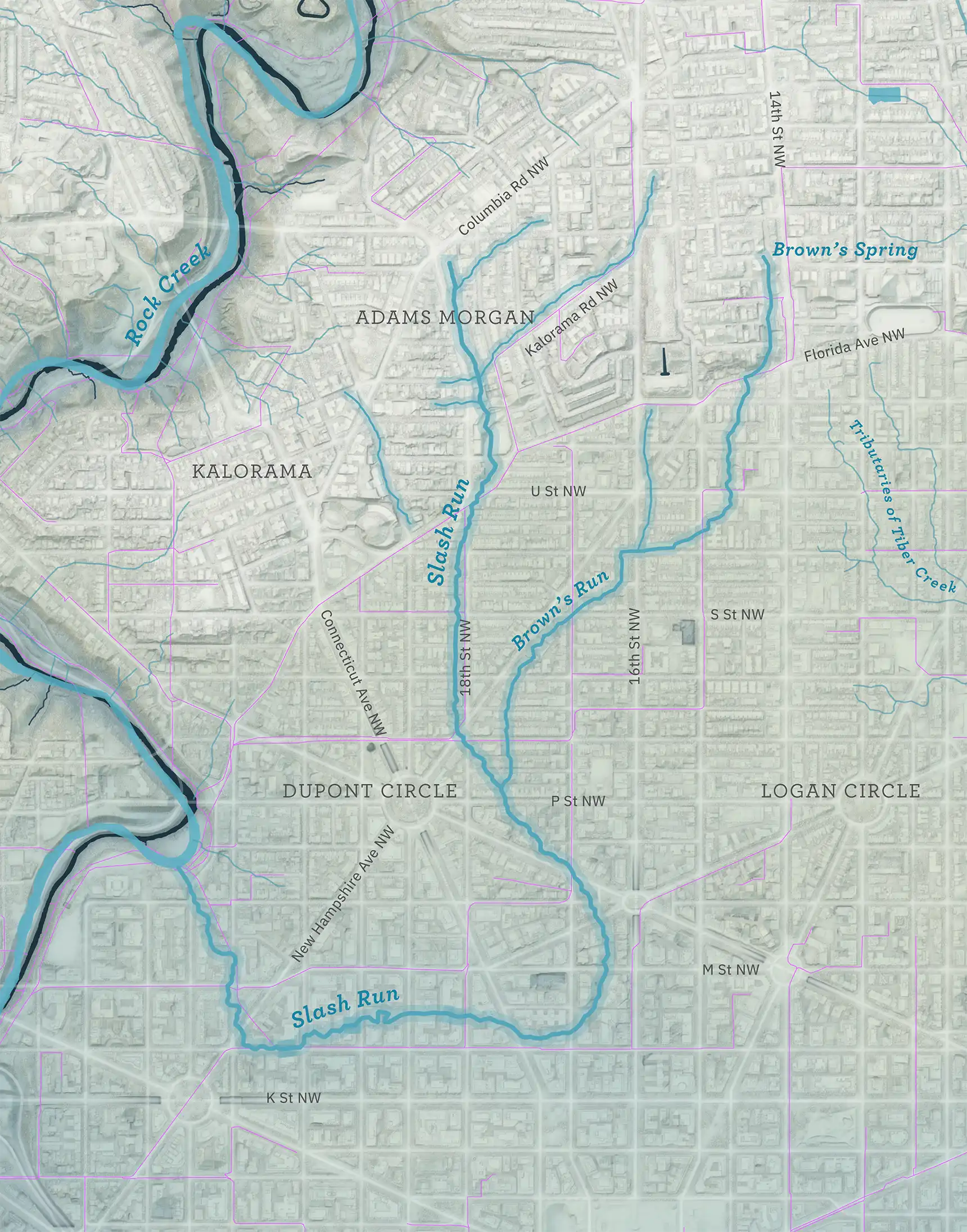
Slash Run and Brown’s Run, superimposed onto the neighborhoods of today. This map shows a reconstruction of the city’s streams in the early and mid-19th century, drawing from Albert Boschke’s 1861 map and adding inputs from other sources. The positions of historic features are imprecise and incorporate educated guesswork.
Rain garden at Marie Reed Elementary School in 2019, sown with water-loving plants of the kind that might have grown by Slash Run.
From stream to sewer
Slash Run’s waters grew foul from household and slaughterhouse waste and, in any case, streams on the surface presented obstacles to a city’s expansion. The District government had diverted the downtown waterways into sewers, starting in the early 19th century. Slash Run came next, and the conversion of the stream into a sewer began shortly after the Civil War.
Adams Morgan, as seen on a US Coast and Geodetic Survey map from 1892, with modern-day streets overlaid in red. Slash Run flows down the paths of Champlain Street and Kalorama Road. (Original map via Library of Congress.)
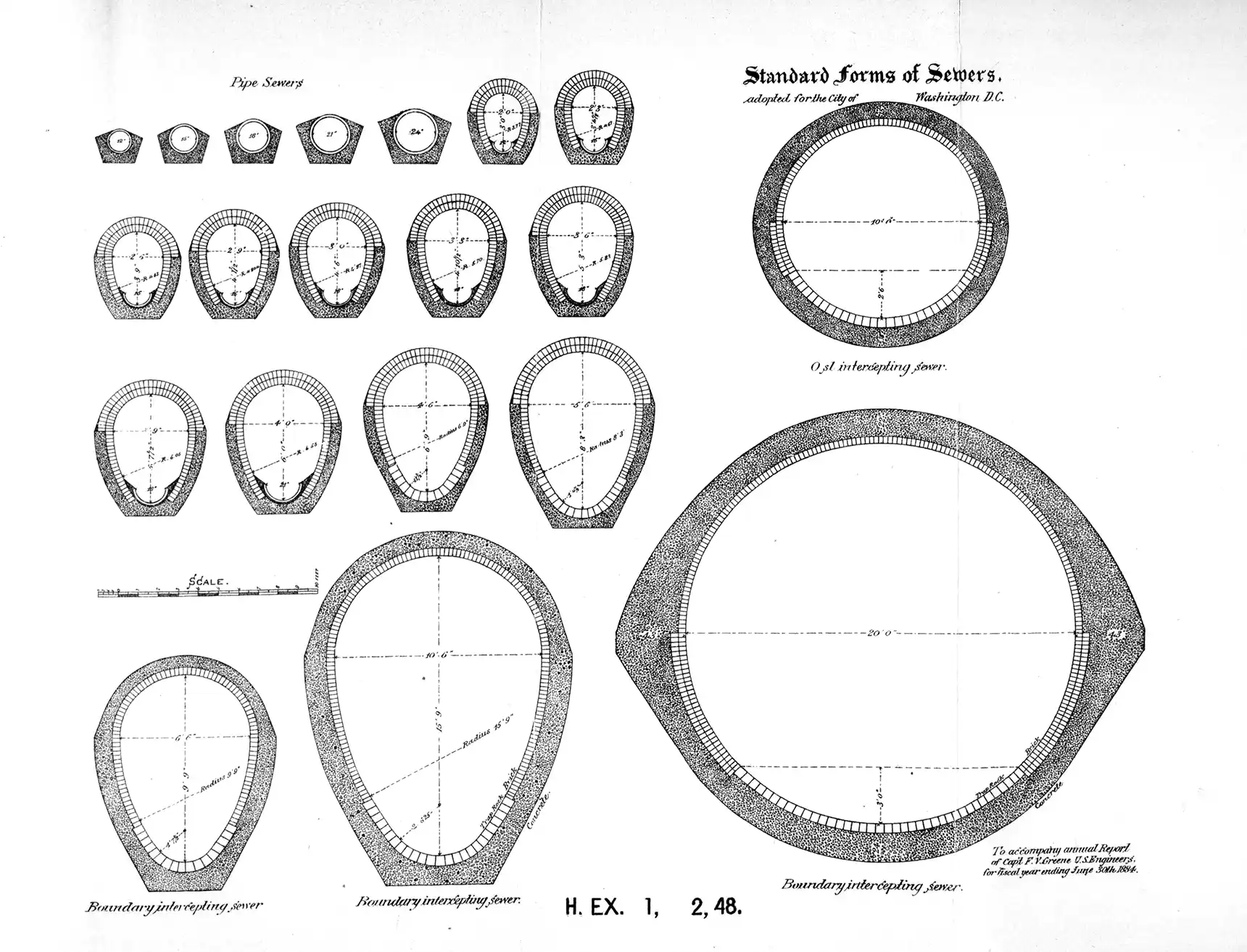
Standardized designs for sewers, from the Annual report of the Board of Commissioners of the District of Columbia for 1884.
A report from the Engineer Commissioner, published in the National Republican on Dec. 8, 1874, says that:
“The Slash run sewer was completed before the present season, with the exception of the gravel pit and 712 feet of four-foot sewer at the upper extremity.”
“There is no existing contract for this work, but it should be done during favorable weather this winter, to take up the stream which now runs through the northwestern section of the city. The estimate cost is $8,461.25. The lower part of this sewer has been carefully inspected, and appears to be in good order. The outlet being in Rock creek, an abundance of fresh water is provided for the neutralization of all the present sewage, but the dam at the mouth of the creek should be removed.”
By the turn of the century, new streets and new houses were spreading into the outlying parts of the District above Florida Avenue. With them came new segments of sewer. A construction company might route a stream into a pipe, or fill in a small valley with earth. Sometimes brooks and springs simply dried up for want of water, the rainfall that fed them diverted into pipes farther uphill.
Slash Run faded from view and passed from memory. In 1918, the Biological Society of Washington published a gazetteer, intended as a compendium of notable natural sites across the whole region. The index names over 150 streams in the DC area, but Slash Run is absent.
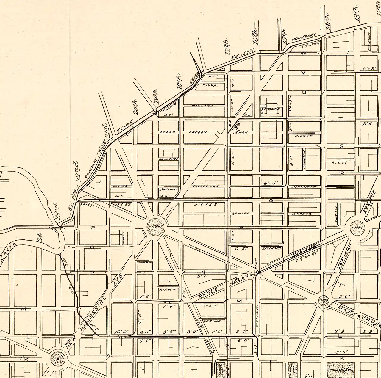
New sewers in the Slash Run watershed. Detail of a map of the District’s sewers, from the report of the Engineer Commissioner, 1885. (Via Library of Congress.)
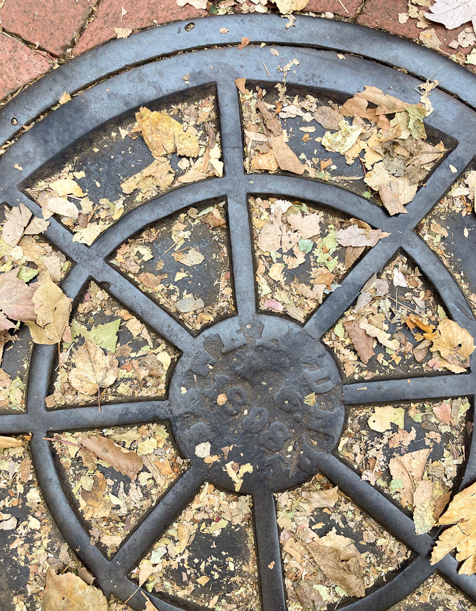
A manhole cover on Champlain St. NW. The lettering reads “Sewer Dept. D.C. 1898.”
Data sources
The maps of historic streams use data from:
- DC DOEE Historical Streams: the “Boschkecentric” stream network and digitized hydrographic features from the Boschke map, surveyed 1856–1859 and dated 1861. Produced by Straughan Environmental and David Ramos for DC DOEE. The project that generated these data, Uncovering the History of the District’s Buried Streams, provides more background about the city’s watercourses and discusses what could happen in the future.
- A January 24/26, 2022 LIDAR survey of the District, via Open Data DC: 1m hydro-enforced DTM (digital terrain model) and the 1m nDSM (normalized digital surface model) (CC BY 4.0).
- USGS National Hydrography Dataset
- DC DDOT Street Centerlines
- Hydrographic feature names from Garnett P. Williams, “Washington, D.C.’s Vanishing Springs and Waterways: Geological Survey Circular 752,” U.S. Geological Survey, 1977.