More D.C. streams in 1859
I’ve just updated the historic streams map for a bike tour of the SE/SW waterfront with KCDC.
As DC grew, the city buried its streams, diverting their waters into sewers. With historic maps, it’s possible to trace the paths of those lost watercourses.
Streams, shorelines, marshes, and canals of Washington, D.C. in 1857, overlaid on the modern city. The 19th century marshes appear in green, and tidal flats in brown. Historical data come from Albert Boschke’s 1863 map.
Here’s the hydrographic situation in 1859
Slash Run (now the namesake for a burger joint) flowed from Adams Morgan down through Dupont.
Tiber Creek is the big boy, draining much of the city. It ran from a spring in the present-day McMillan Reservoir down through Union Station—Swampoodle—and past the Capitol Building. At the Mall, Tiber Creek merged into the ill-fated Washington City Canal and debouched into the Potomac’s wide tidal. There was a large public wharf at the end of the canal, along 17th St. below the White House.
James Creek
James Creek ran from near the James Creek Marina up to Eye St. SW. It split the southwest waterfront in two, dividing Buzzards Point from Greenleaf Point. The creek might have flowed more freely at the time of the city’s founding, but by 1859 it was already a marsh.
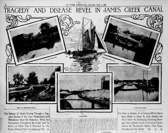
“Tragedy and Disease Revel in James Creek Canal,” Washington Times, 4 May 1902. (PDF at Library of Congress.)
In the 1870s, a city project turned the marsh into a canal, host to schooners and barges delivering lumber and sand to the surrounding industries. Pedestrians fell down the canal’s sloping sides and drowned, and the slow-moving waters spread foul air over the neighborhood.
Southwest Waterfront
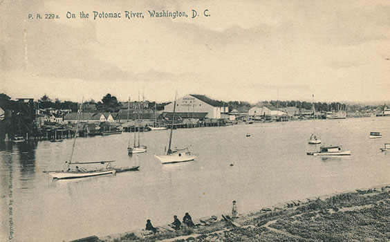
Southwest Waterfront, 1905 postcard.
The Potomac River waterfront, downstream of the 14th St. bridges, served steamer traffic to the rest of the Chesapeake Bay. The Municipal Fish Market was located there, as well. When the market’s buildings were razed in the 1960s, the vendors moved to boats and barges moored along the wharf.
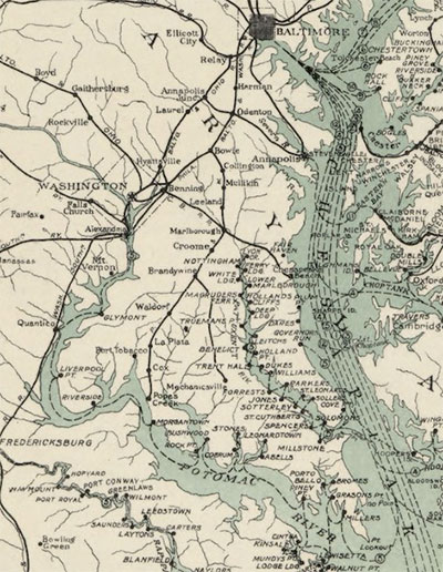
Chesapeake Bay steamboat lines. Map by U.S. Army Corps of Engineers, 1926.
Marshes
West of the Mall, much of the Potomac was tidal flats, mud at low tide. East Potomac Park on Hains Point was created by Corps of Engineers dredging work in the first decade of the 20th century.
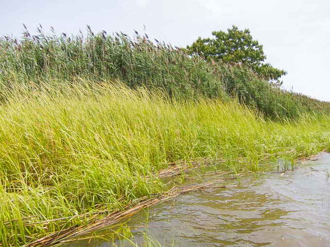
Marsh grasses. Parts of the Anacostia would have looked something like this in 1859. These grasses are elsewhere, but today, there are a growing number of healthy marshes along the Anacostia.
Similarly, there are large expanses of marshland along the Anacostia—not bare mudflats, but wetlands that were host to semiaquatic vegetation. That slow-flowing river was already beginning to clog with sediment washed down from Maryland farms. The Anacostia’s modern shoreline is also mostly the result of 20th century dredging and landfilling.
About the map
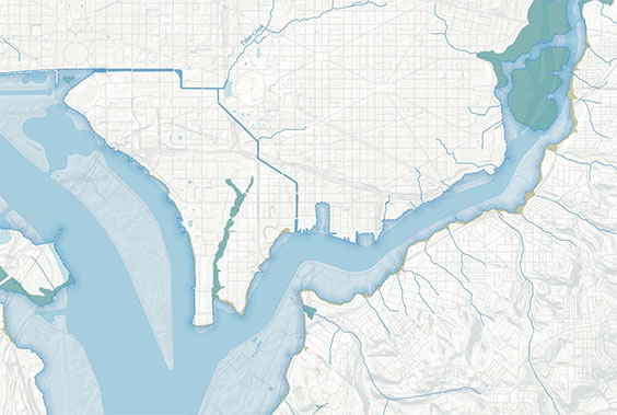
Shorelines, tidal flats, and marshes are complete along the Anacostia, and on both banks of the Potomac up to Rock Creek. DC’s northern and western areas, and the Potomac below National Airport, remain undigitized.
Data sources
Historic data from Albert Boschke’s 1856–1859 survey, published as a map in 1863. Modern data from DC GIS and OpenStreetMap. DEM (topography) from USGS. More about this project.
Updates
2016-02-28: Added Potomac River shorelines upstream to the Three Sisters; the C&O Canal and the northern reaches of the C&O Canal’s Alexandria Extension; and Rock Creek to P St.