Swampoodle is back on Google Maps
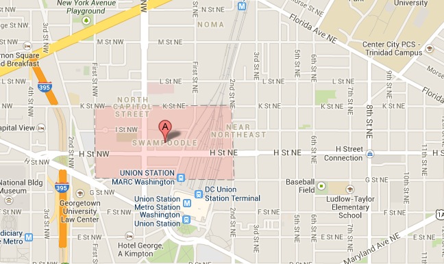
The historic Washington, D.C. neighborhood of Swampoodle has been missing from the maps for some decades now. Now it’s back!
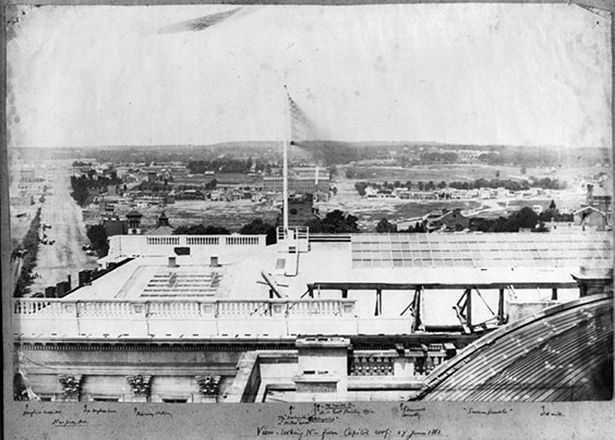
Looking north toward Swampoodle from the U.S. Capitol, 1861. Image from the Library of Congress.
A hub of Irish-American settlement, Swampoodle grew up in the mid 19th century, taking its name from the marshy ground around Tiber Creek. Most of the area was covered by the tracks of Union Station in the first decade of the 20th century. Eventually the name faded.
Now, though, you can find Swampoodle on Google Maps.
I submitted an edit to Google Maps about a month ago, adding Swampoodle as an historic neighborhood. The team accepted the edit. It looks as if the change has cascaded down to the regular Google Maps database.
Chalk one up for historic neighborhood names. You, too, can report problems and add information to Google Maps (and to OpenStreetMap).