Historic streams map, 2013 version
[The interactive map is not currently available. It was hosted on an older mapping service, which has now been sunset, but there are other, newer, streams maps on this site.]
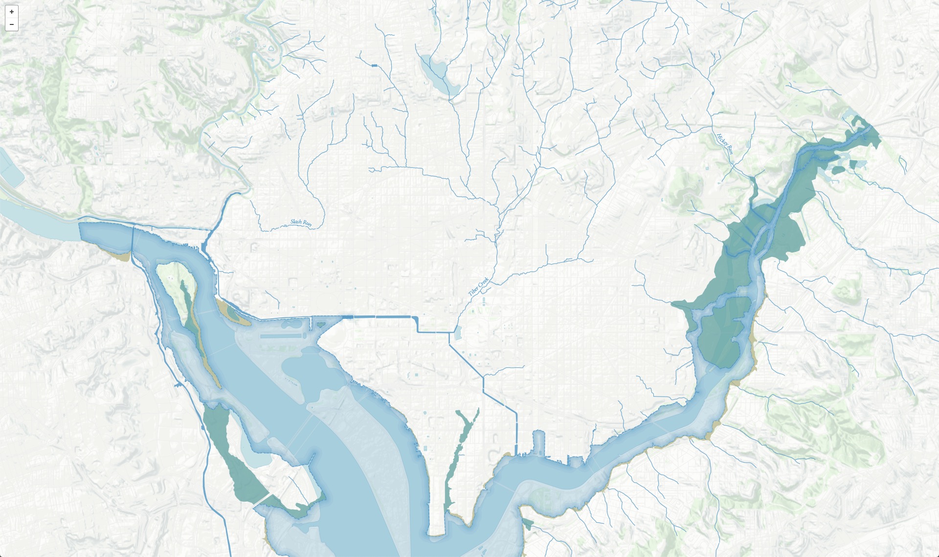
This map shows the Tiber Creek, Slash Run, and James Creek stream systems in Washington, D.C. in the middle of the 19th century. These three streams have been filled or diverted into sewers. Some reaches of Hickey Run, in Northeast, still flow on the surface.
Shorelines, tidal flats, and marshes are complete along the Anacostia, and on both banks of the Potomac up to Rock Creek.
Historic data come from Albert Boschke’s 1856–1859 survey, published as a map in 1861. Modern data from DC GIS and OpenStreetMap. More about this project. This version of the map created 2013.