Sense Mapping
GDES-270 spring 2020 (David Ramos, American University Design)
ramos@american.edu · office hours
Create a map that presents the layout of a space, and displays the nature and intensity of the sensory inputs that you encountered. Through this project, you’ll explore ways of representing information in visual form, and walk through a four-stage design process.
See Kate McLean, Sensory Maps.
Process
Design is a process of observing the outside world, reflecting on what you see in a way that incorporates both cultural context and personal insight, making a tangible product, and testing different versions of that project. A designer might run through these phases in series, but they could also move back and forth between steps, cycling through parts of the process in response to what they learn.
This project introduces all four phases. We’ll take them in series, at first.
For due dates, see the class schedule page.
1. Observe
Go out and walk around some area that you’re curious about. (Take drawing and writing implements with you.) Be aware of the sensory cues that the environment provides—what you see, hear, smell, and feel.
Gather three kinds of information:
- Where you went, enough that someone else could follow your route.
- Visual/spatial information about what you saw, in a big-picture sense.
- More detailed, idiosyncratic information that comes from a non-visual sense (hearing, smell, touch, and the like), or requires looking closely (texture, a close-up view).
Spend half an hour walking around, making a sketch map of your experience. This isn’t a final map, just a form of taking notes—don’t get too attached.
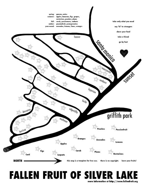
Fallen Fruit of Silver Lake, by Fallen Fruit.
2. Reflect
Back in your workspace, think about what you experienced, and start considering ways that you might represent the sensory information.
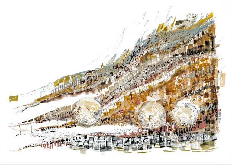
Soundmarks, Aldborough Roman Town, a collaboration between Rose Ferraby and Rob St. John. This piece by Rose Ferraby.
3. Create
Make a first version of a map. Aim to use a minimum of text. You’ll have to decide on a system for representing the key features of the place, and another system for encoding the sensory inputs.
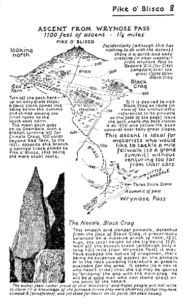
A Pictorial Guide to the Lakeland Fells, Alfred Wainwright.
4. Iterate
We’ll critique and test your first version. In response to this feedback, make new versions of the map that explore different approaches and improve on existing ones.
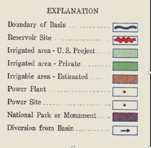
From “Colorado River Basin” map, U.S. Bureau of Reclamation, 1928.
Specifications
- Work by hand, using pen or pencil on paper. (Ballpoint pen will probably make for sad results.)
- Color or black and white.
- Use as few words as possible.
- The map should be at least 8.5×11 in.
To turn this project in, photograph or scan your map and upload the resulting image.