New map: From Bay to Mountains
What made Baltimore into a center of American railroading? Why was the Long Bridge so important that, during WWII, the federal government built an alternative, emergency crossing? How do heavy trains cross the Appalachians? (Details »)
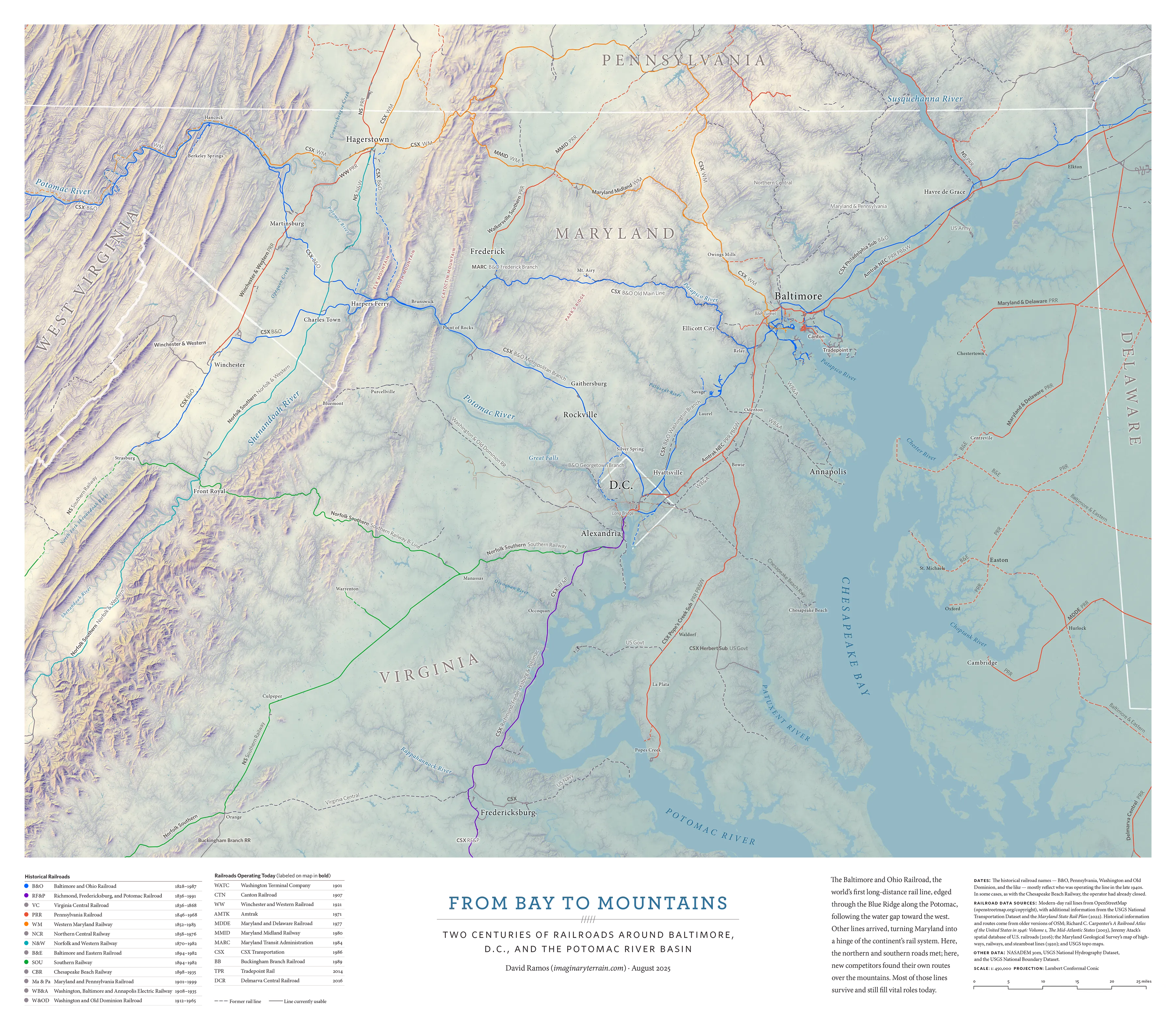
This is a map of the rail lines around Baltimore, D.C., and the Potomac River Basin. It shows the network against the topographic and hydrographic features that determined its shape. Every major line appears, all the way back to the first stretch of the Baltimore and Ohio Railroad, laid in 1828, marked with their historical and present-day operators.
Hillshading process
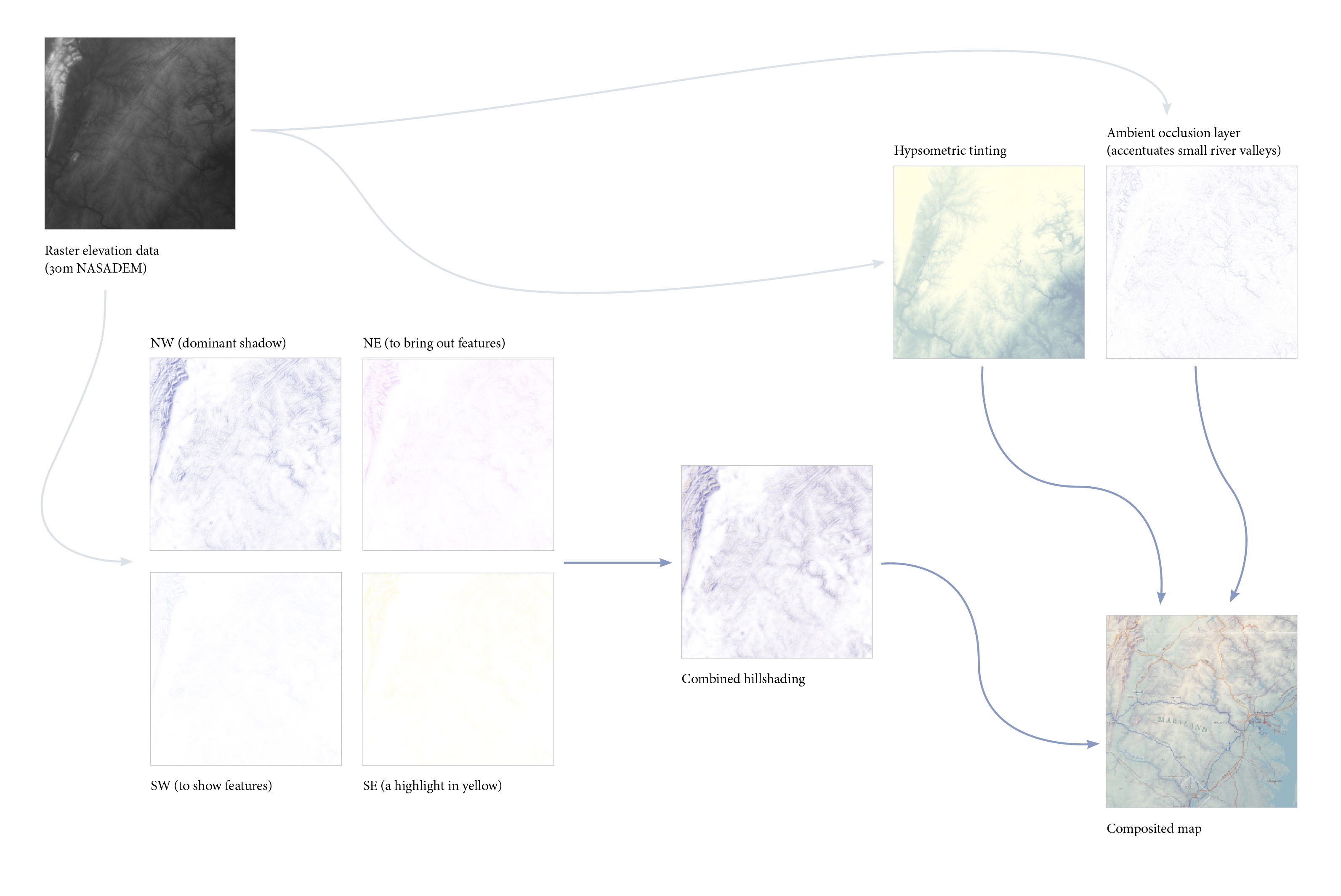
The legible, expressive rendering of terrain is key to this map. The hillshading on this map, inspired by Swiss mountain maps, uses multiple light sources and several different types of shadow, in order to convey information about slope, aspect, and elevation.
Project page
There’s more about this map, with details and photos, on the From Bay to Mountains project page.