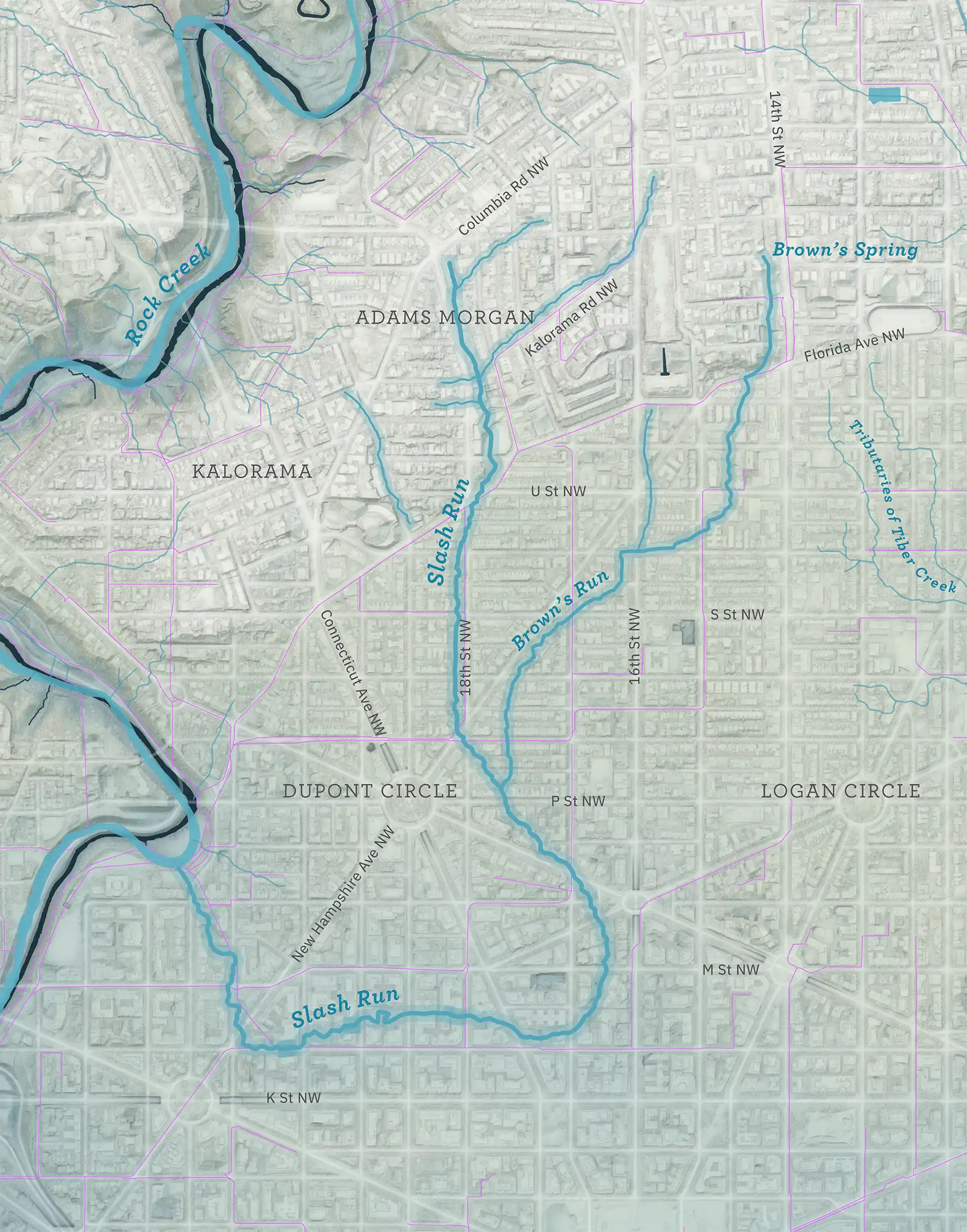
Lost streams: Slash Run
Before D.C. grew into its modern form, with its rowhouses and stores and apartment buildings, most of its 68 square miles was covered in fields and pasture, broken by wilder patches of woods, brush, and marsh. A network of streams flowed through this landscape, running from the hills down to the tidal waters of the Potomac and the Anacostia. Most of those watercourses — 70 percent — are gone today, their flow routed into culverts and sewers, or the rainfall that sustained them instead diverted into storm drains. We can reconstruct their paths, though. This piece is the first of a series, visiting the District’s lost streams, one watershed at a time.
This map lays the courses of the long-vanished Slash Run and Brown’s Run onto the contemporary city. The blue lines are ● historic streams . Purple lines follow the large-diameter ● pipes that carry rainfall today. The present-day ● surviving waterways appear in dark blue.
A 19th century city
The streams here are a model of what the city looked like before the Civil War, based largely on Albert Boschke’s 1861 map. Positions are imprecise and the product of educated guesswork.
Slash Run
Slash Run emerged near the ridgeline above present-day Adams Morgan and flowed down the line of 18th St. Small tributaries entered from valleys along the way. (Some of the valleys are still visible, like the ones around Kalorama Rd. and 19th St.) It circled wide around Dupont Circle and emptied into Rock Creek around P Street Beach, which was then the site of a large oxbow. Conversion of the stream into a sewer began shortly after the Civil War.
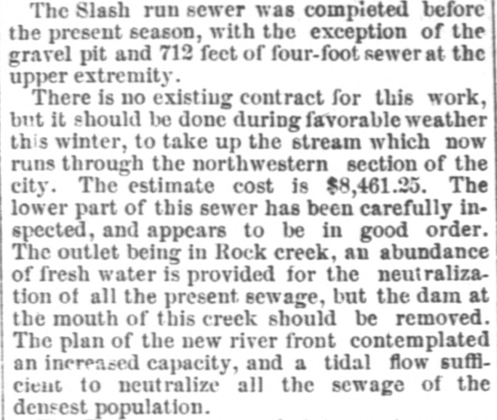
A report from the Engineer Commissioner, published in the National Republican on Dec. 8, 1874.
Brown’s Run
Brown’s Run was a tributary of Slash Run. It began at Brown’s Spring, around 14th and Clifton. It flowed past U St. and joined Slash Run near Dupont Circle.
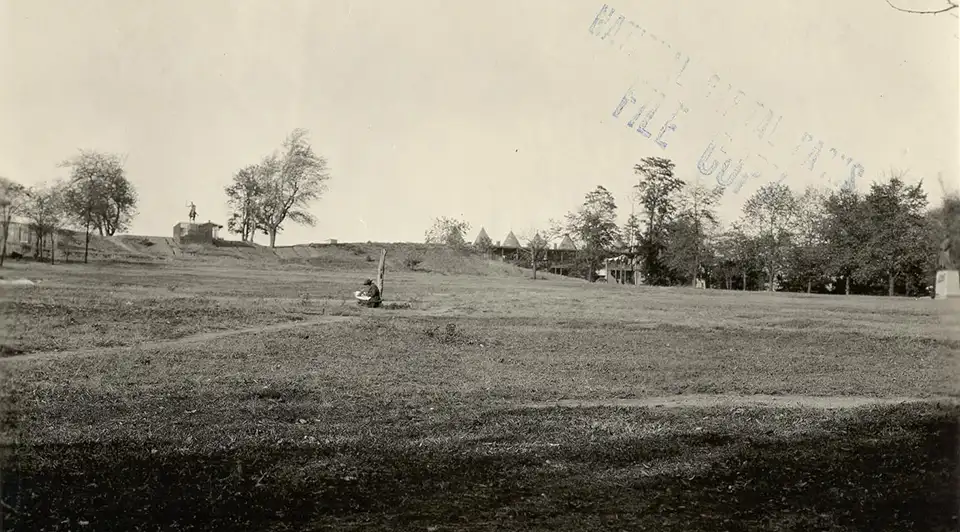
Meridian Hill Park (locally known as Malcolm X Park), around 1922 and before the construction of the cascade and terraces, via NPS. Brown’s Run flowed down this escarpment, about half a block to the east.
Combined sewers
This watershed has become home to some of the city’s most densely-populated neighborhoods, and rainfall now washes into the combined sewer system.
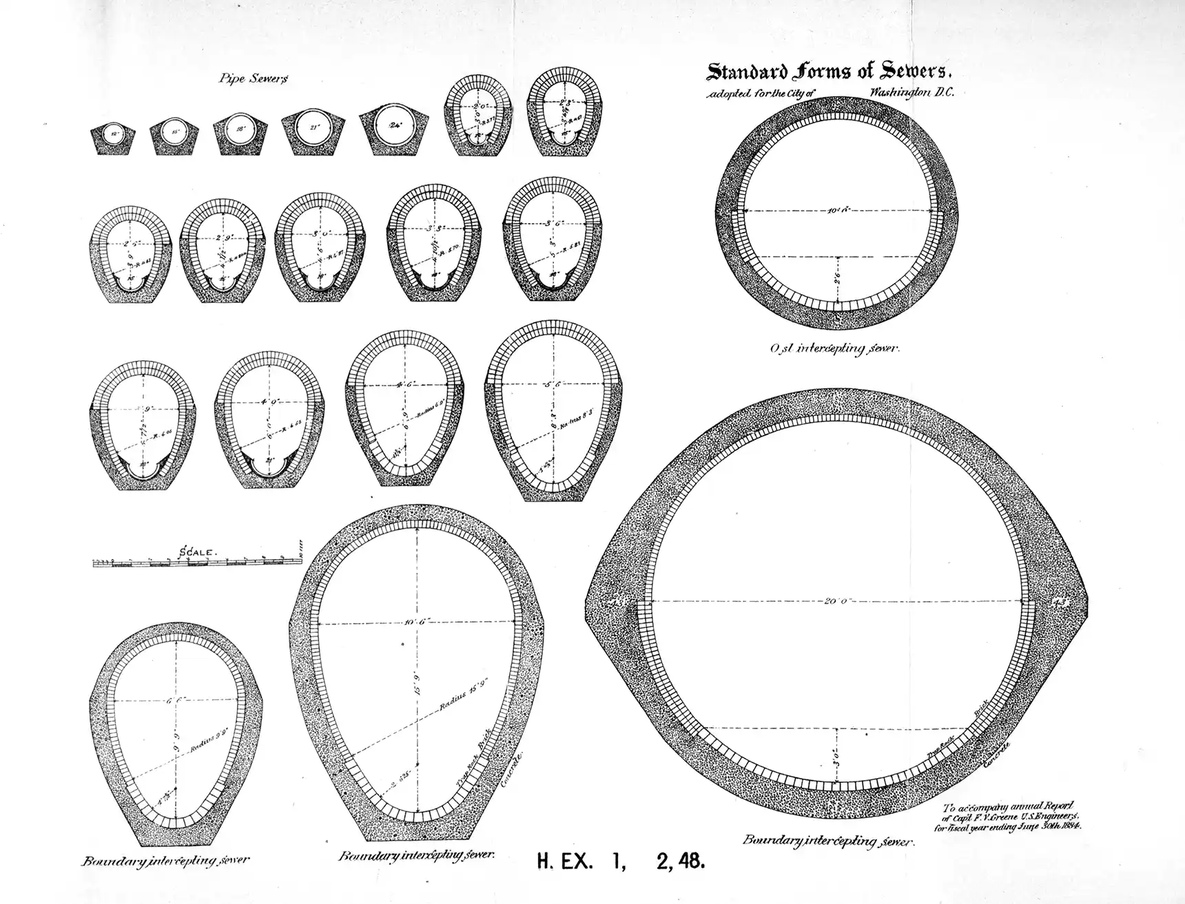
Standardized designs for sewers, from the Annual report of the Board of Commissioners of the District of Columbia for 1884.
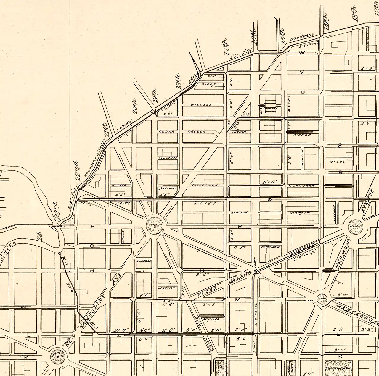
The Slash Run watershed, diverted into the city’s new sewer system. Rainfall would be captured by a network of pipes, some of them flowing in different directions than the surface streams that they replaced. Detail from a map of the District’s sewers, produced for the report of the Engineer Commissioner, 1885. (Via Library of Congress.)