Citywide streams map (2021/2023 ed.)
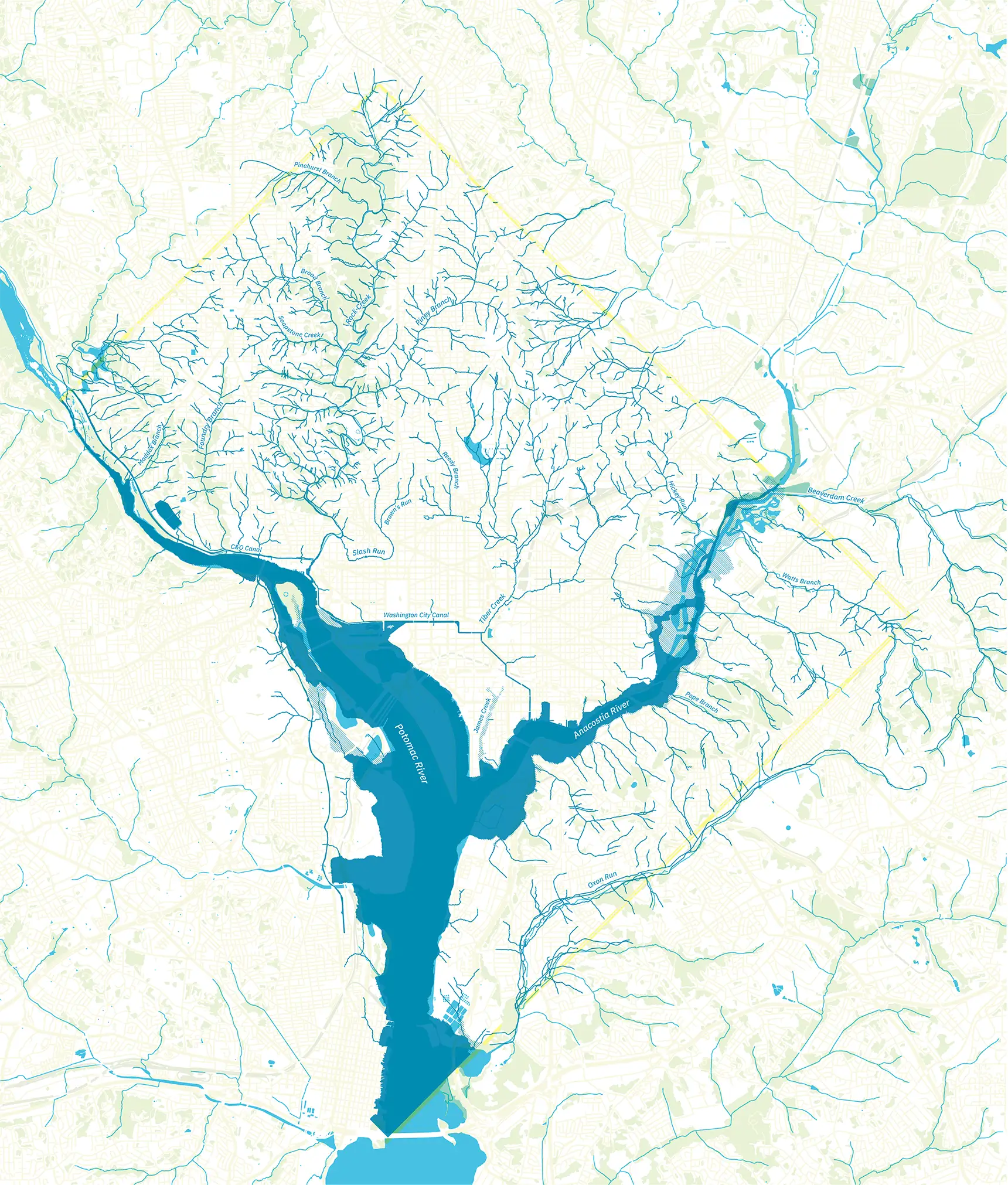
The historic stream network shown here is an estimate of the District’s rivers, streams, and marshes before urbanization, from a 2019–2021 project carried out by Straughan Environmental for the D.C. Department of Energy & Environment. It draws mostly from Albert Boschke’s 1861 map, but it integrates data from many sources, including maps by Andrew Ellicott (1792), Richard Delafield for the War Department (1865/1891), H.F. Walling (1873), S. Augustus Mitchell (1879), G.M. Hopkins (1879), the Board of Sanitary Engineers (1889), and the USGS. Stream locations are approximate and conjectural. Modern-day data from USGS NHD, OpenStreetMap, and USGS NLCD.
Published 2021, revised 2023. Designed by David Ramos (imaginaryterrain.com), with support from the AU Humanities Truck. First edition printed by Mount Vernon Printing, Laurel, Md.