Equitable Transit-Oriented Development Maps for GGWash
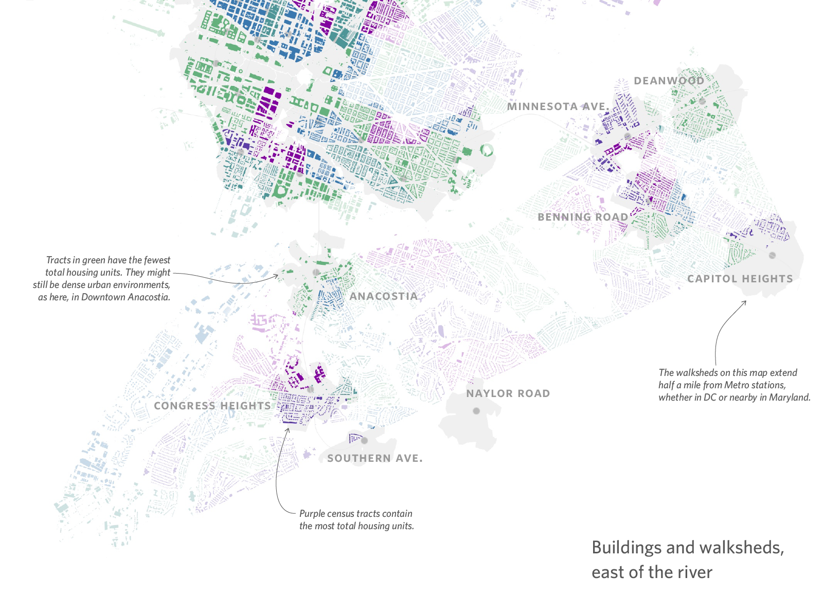
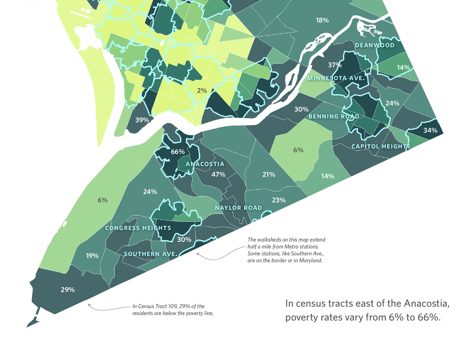
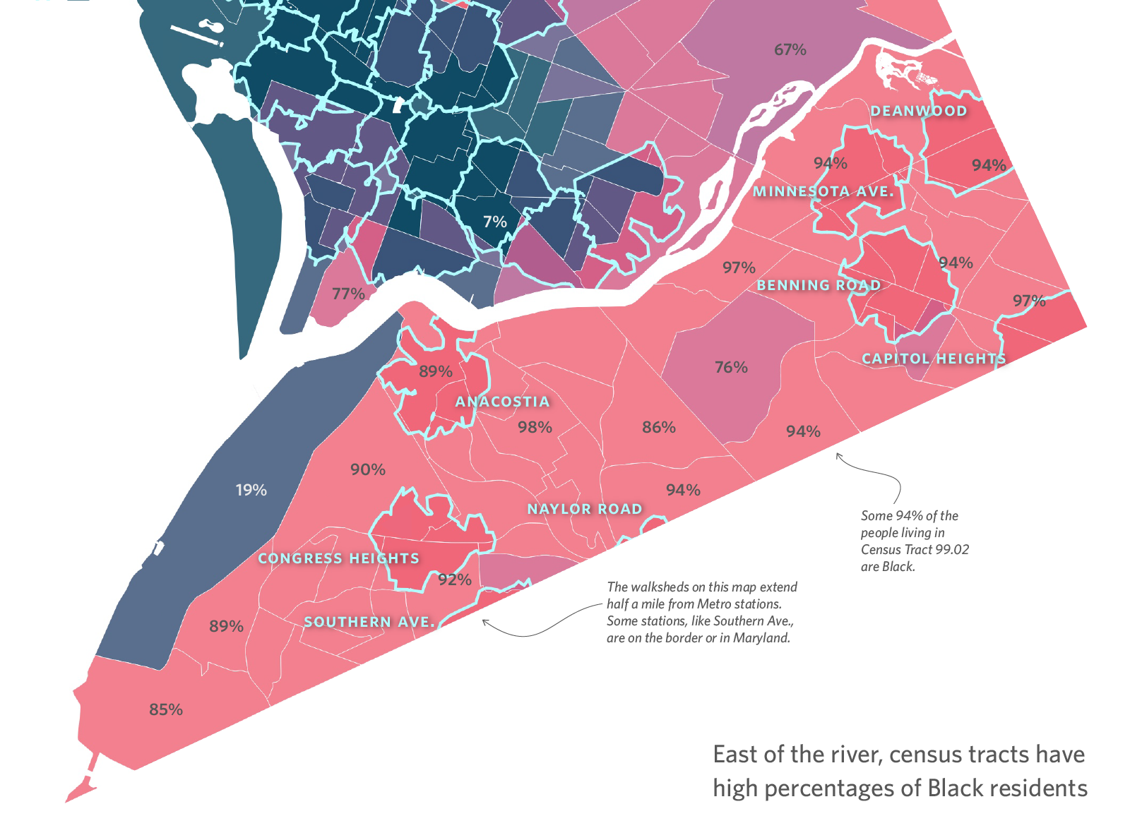
These maps accompany a series of articles about equitable transit-oriented development, published on Greater Greater Washington, an urban issues news and analysis site. The three maps here ran as part of a story about issues facing underserved neighborhoods east of the Anacostia River.
- Areas of work
- Cartography and GIS
Sources
Data from the Census Bureau, WMATA, and USGS; and from DC Open Data under a CC–BY 4.0 license.