Visiting Bodkin Island before it slips under the waves
Once home to farmland and pine trees, a heron rookery and nesting ducks, Bodkin Island is a rapidly-eroding speck in the Eastern Bay. It’ll soon slip beneath the Chesapeake’s waters.
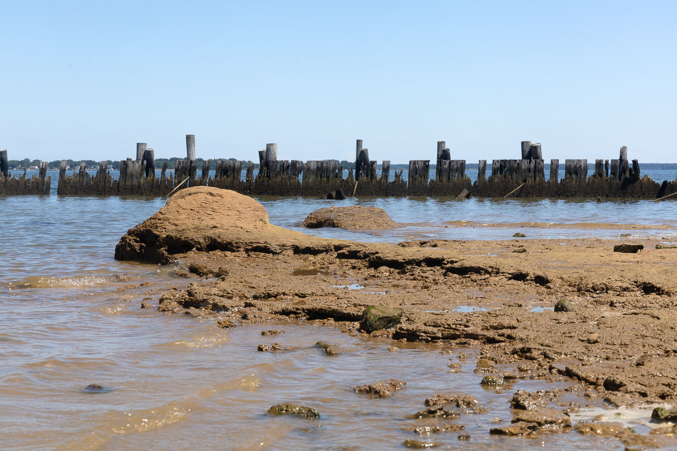
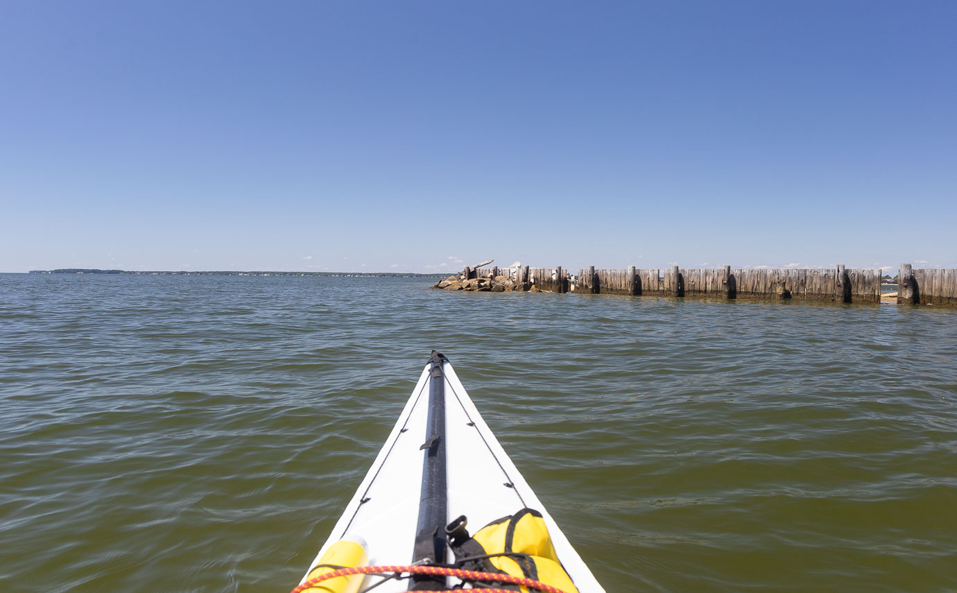
August, 2023: All that remains of Bodkin Island is two clay islets and a wooden bulkhead backed by shells and riprap. The island’s last private landowner placed the bulkhead in the early 1980s, in an effort to protect the island from erosion.
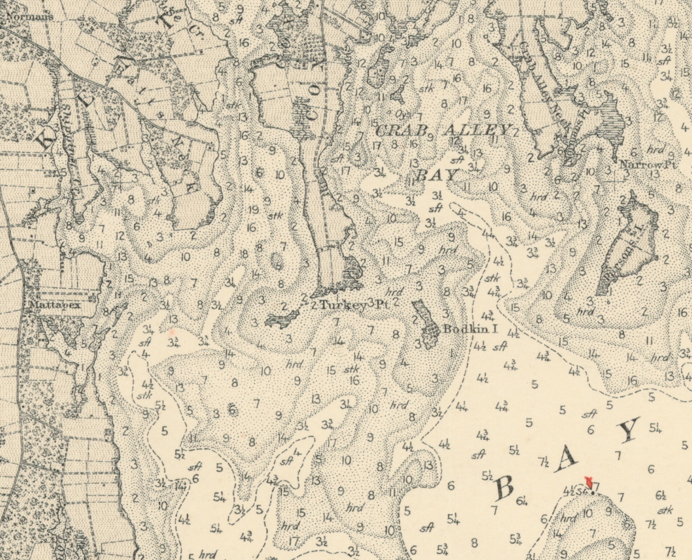
Some 115 years ago, the island still had trees and an orchard. U.S. Coast and Geodetic Survey Chart, Chesapeake Bay Choptank River to Sandy Point, 1908.
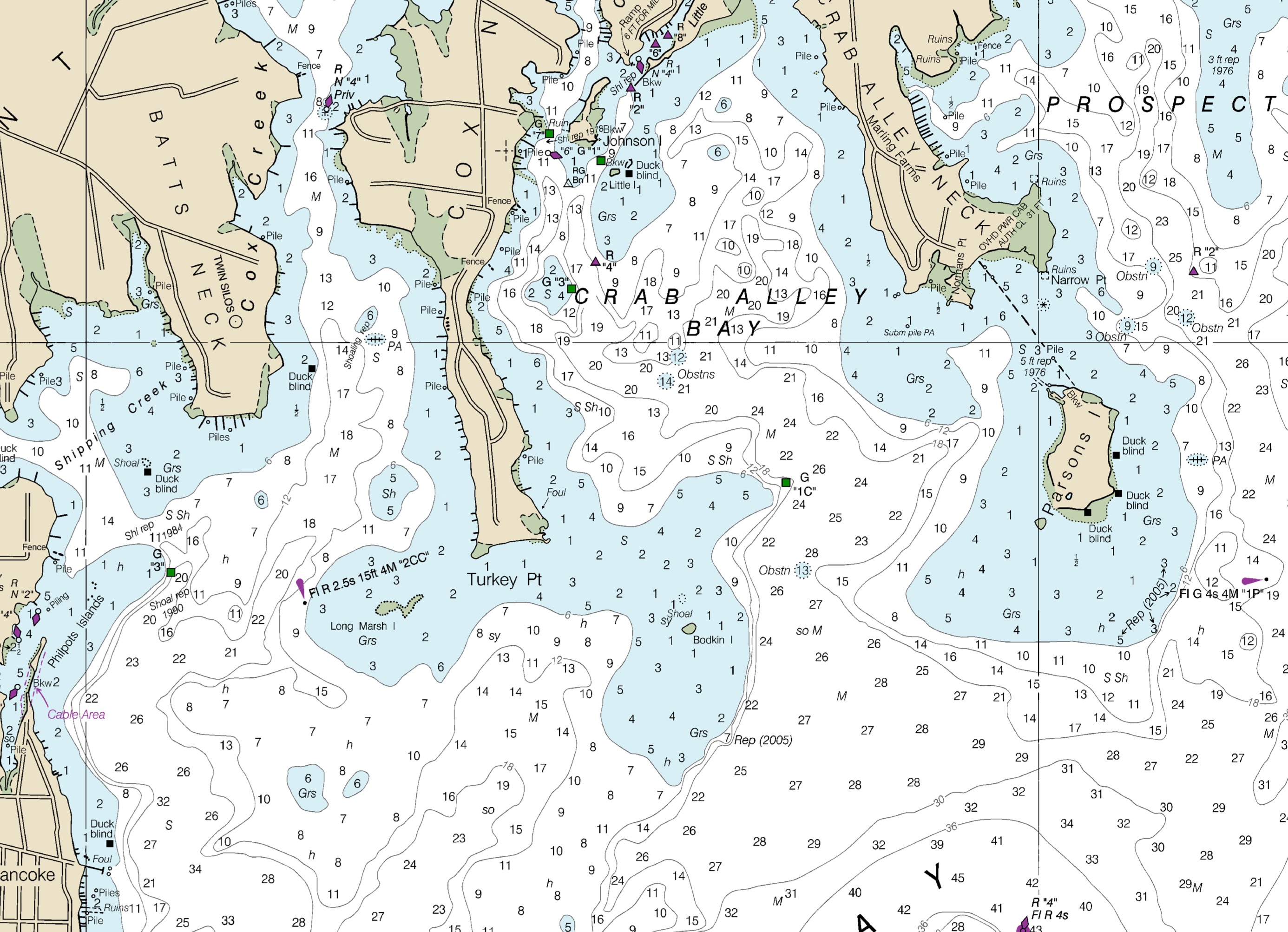
NOAA Chart 12270, Chesapeake Bay: Eastern Bay and South River, 2023.