From Bay to Mountains
A map of railroads around Baltimore, D.C., and the Potomac River Basin, showing present-day and historical lines against the mountains, terrain, and rivers that drove their alignments.

The Baltimore and Ohio Railroad, the world’s first long-distance rail line, edged through the Blue Ridge along the Potomac, following the water gap toward the west. Other lines arrived, turning Maryland into a hinge of the continent’s rail system. Here, the northern and southern roads met; here, new competitors found their own routes over the mountains. Most of those routes survive and still fill vital roles today.

An engraving of the Thomas Viaduct, which carries the Baltimore and Ohio line across the Patapsco River. Published in The United States Illustrated, c. 1858. (From HAER survey MD–3, via Library of Congress.)
The Potomac River offers one of the few good routes across the mountains and toward the Ohio River Valley. From the north, rail lines to Philadelphia and New York cross the Susquehanna and wind through Baltimore. From Richmond and the south, lines cross over Long Bridge and enter D.C.

Central Maryland and the surrounding area.


CSX drawbridge over Curtis Creek, Baltimore.

Potomac River, Blue Ridge Mountains, and Shenandoah Valley.
Through the Blue Ridge and along the Shenandoah
West of Harpers Ferry, the B&O and Western Maryland lines hug the banks of the Potomac, winding through the mountains. North–south lines enter through the wide Shenandoah Valley.
A single rail car can weigh over 100 tons. Trains can move tonnage efficiently, but there are limits to the grades that they can climb; bridges and tunnels burn through precious capital. Hills, mountains, rivers, and marshes all drive the alignment of trackage. The story of the railroads is a study in topography.

Lines along the Chesapeake’s deeply-indented coastline.
The Eastern Shore and the Western Shore
A series of shortlines and Pennsylvania Railroad branches served the Eastern Shore, connecting with ferries and steamboats, carrying seafood and canned produce to market. On the Western Shore, the Washington, Baltimore, and Annapolis Electric Railway linked the cities with the state capital, and the short-lived Chesapeake Beach Railway sped vacationers to the Bay's waters.
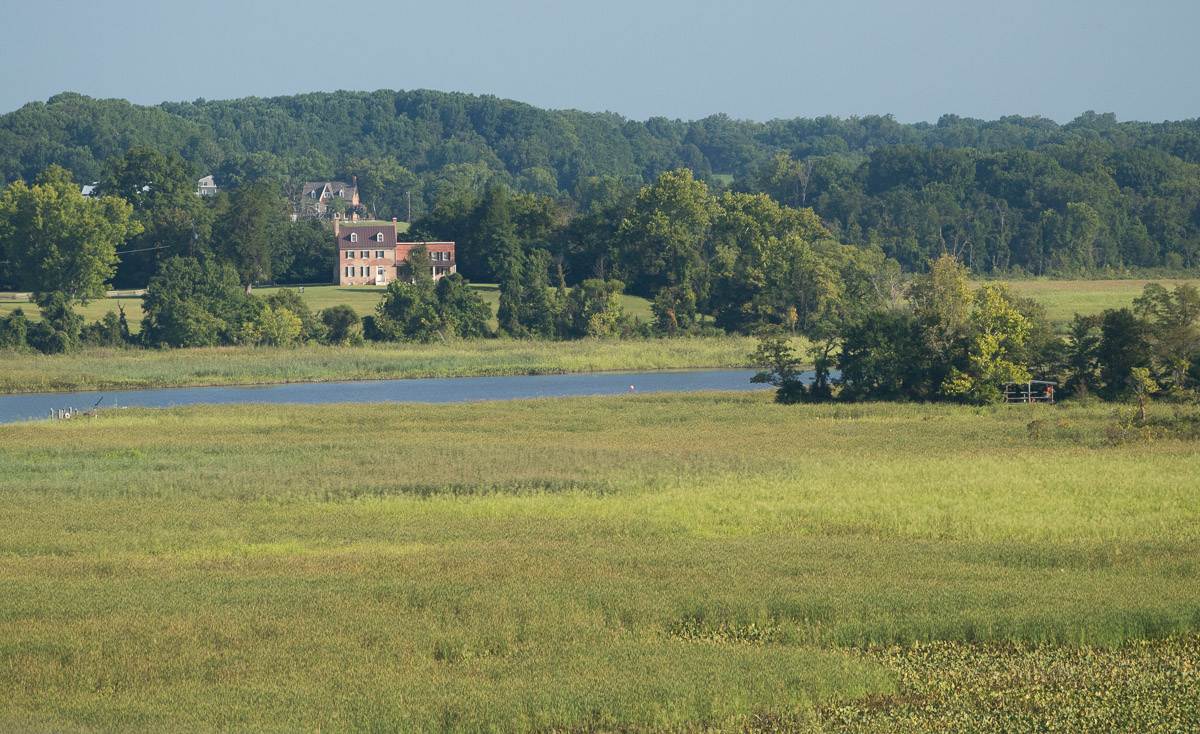
The Chesapeake Beach Railway crossed the Patuxent at Jug Bay. The trees at right are the old railbed, and the pivot of a drawbridge is just visible in the center of the channel.

Southwest of Washington, D.C.
The Virginia approaches to D.C.
The Richmond, Fredericksburg & Potomac was jointly owned for most of its history. Long Bridge, in D.C., provides the only Potomac River crossing east of Harpers Ferry, 60 miles away. Access to the South always plagued the B&O; the Georgetown Branch began as a way of securing a new route. During the Second World War, the federal government had the B&O Railroad construct the temporary Emergency Bridge, linking far southeast D.C. with Alexandria.
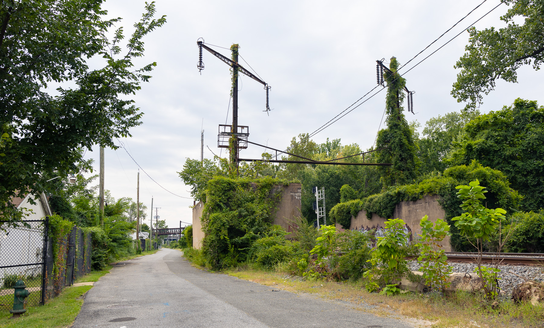
This is the CSX Alexandria Extension, wedged between the Anacostia River and Capitol Hill. It is a former Pennsylvania Railroad line, once electrified under that company's 25 Hz traction power system.

North and west of Baltimore.
The Northern approaches to Baltimore
North of Baltimore, the Pennsylvania Railroad and the Baltimore and Ohio main lines ran along the broad coastal plain, crossing the Susquehanna at Havre de Grace. Two shortline railroads entered Baltimore from the north — the Northern Central Railroad and the Maryland and Pennsylvania (the "Ma and Pa"). The Western Maryland swept in from the northwest.
Hillen Terminal, a former Western Maryland Railway freighthouse and passenger station, located along the Jones Falls in Baltimore.
Notes
Dates
This map shows every major rail line that has existed in the region. The historical railroad names — B&O, Pennsylvania, Washington and Old Dominion, and the like — mostly reflect who was operating the line in the late 1940s. In some cases, as with the Chesapeake Beach Railway, the operator had already ended operations.
Interurbans
The interurban craze only touched this region lightly. Trolley lines and interurbans, including routes outside of D.C., near Baltimore, and between Frederick and Hagerstown, are largely not represented on this map. The Chesapeake Beach Railway, Washington and Old Dominion Railroad, and Washington, Baltimore, and Annapolis Electric Railway do appear, because they were more durable presences, important to the region’s transportation picture.
Sources
Railroad data: Modern-day rail lines from OpenStreetMap (openstreetmap.org/copyright), with additional information from the USGS National Transportation Dataset and the Maryland State Rail Plan (2022). Historical information and routes come from older versions of OSM; Richard C. Carpenter’s A Railroad Atlas of the United States in 1946: Volume 1, The Mid-Atlantic States (2003), Jeremy Atack’s spatial database of U.S. railroads (2016); the Maryland Geological Survey’s map of highways, railways, and steamboat lines (1920); and USGS topo maps.
Other data: NASADEM 30m, USGS National Hydrography Dataset, and the USGS National Boundary Dataset.