Lost streams and historical hydrological features of Washington, D.C.
Streams, shorelines, marshes, and canals of Washington, D.C. in 1857, overlaid on the modern city. The 19th century marshes appear in green, and tidal flats in brown. Historical data come from Albert Boschke’s 1861 map.
- Areas of work
- Cartography, GIS, historical geography, and guided tours
- Updates/background
- Project page
I’m interested in water issues and historical land use in Washington, D.C. Working from old maps and reports, I create maps that show the course of long-lost streams and forgotten shorelines. These interactive maps help people understand DC’s hydrographic past.
One of the best sources for the topography of early Washington is Albert Boschke’s 1856–1859 survey, published as a map in 1861. For this ongoing project, I digitized historical maps in a GIS, integrating spatial data with with period texts.
(more)
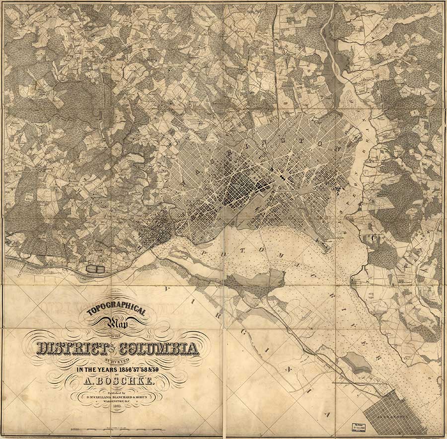
Boschke map, 1861, from the Library of Congress.
Historic streams and neighborhoods tours
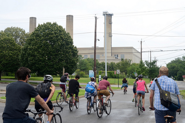
Southeast–southwest waterfront tour, passing the vicinity of the former James Creek. Photo by Laura Battos for KCDC.
In an effort to make landscape history more tangible, I lead tours of DC, exploring underappreciated aspects of the city’s growth. Several of these tours follow the 19th-century shorelines and trace long-lost streams.
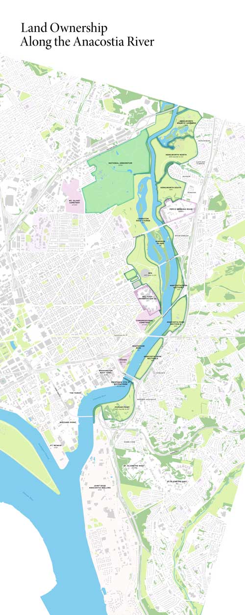
Maps for the Federal City Council
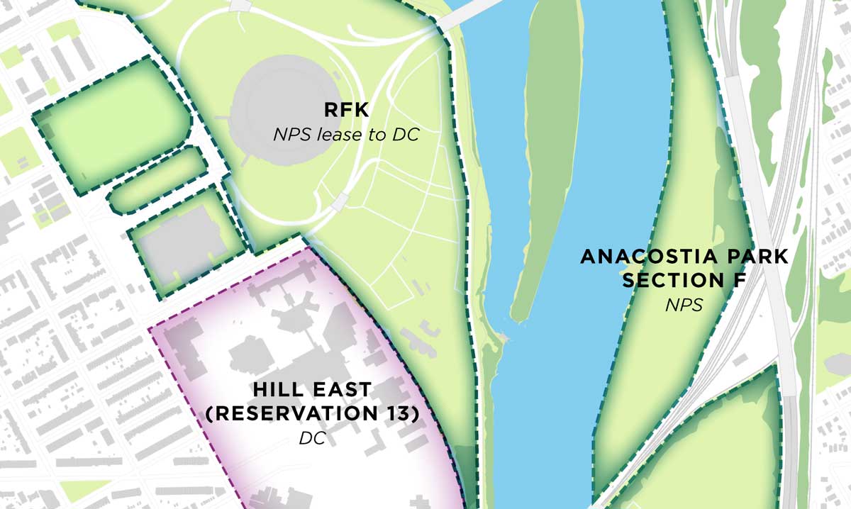
The Federal City Council, aware of this mapping work commissioned a paper map showing land uses and ownership around the Anacostia River, which they used in support of programs about redevelopment, public access to the waterway, and the environment.