GDES-360 spring 2022 / David Ramos, American University Design
11
Introducing mapping tools / QGIS
Wednesday, March 23
Finish Neighborhoods / Start Spatial/final
Projects
- Final critique for Neighborhoods
- Start Spatial/final
Reading
- Look at 10 projects under Bill Rankin’s Radical Cartography.
In class
Data:
- University and College Campuses on DC Open Data (look at the site and download a shapefile)
- Manually digitized building footprints for D.C. (ZIP) (DC Open Data)
- AI-generated building footprints for D.C. (ZIP) (Microsoft, based on aerial imagery of variable age)
- Schools on DC Open Data
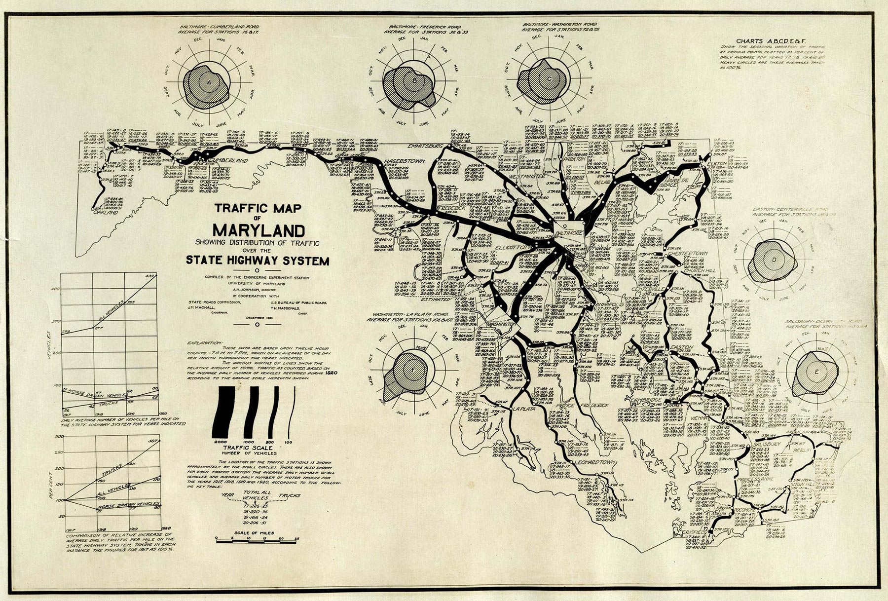
Map of Maryland highway traffic, 1921.